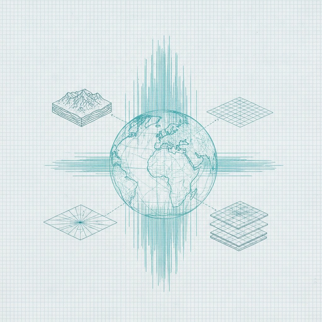
Google DeepMind has unveiled AlphaEarth Foundations, effectively launching a virtual satellite that collapses petabytes of fragmented Earth observation data into a unified vector stream. While the world is distracted by chatbots, Google is quietly re-architecting how we process planetary-scale information, converting optical imagery, radar, 3D laser mapping, and climate simulations into compact embeddings. By carving the globe into precise 10x10 meter squares, the model creates a digital twin that doesn't just look like Earth but functions as a searchable database for coastal waters and terrestrial land.
Technologically, this is a calculated strike against the data fragmentation that has long crippled geospatial analysis. Historically, researchers were trapped in a manual cycle of interpreting inconsistent satellite passes. AlphaEarth Foundations solves this by processing disparate multimodal streams from dozens of public sources into a consistent, machine-readable representation. The efficiency here is notable: according to Google's internal benchmarks, the system’s summaries require 16 times less storage space than competing AI models. For enterprises, this isn't just a technical flex; it’s a massive reduction in the total cost of ownership for planetary-scale monitoring.
To ensure this doesn't remain a lab curiosity, Google has already pushed the Satellite Embedding dataset into Google Earth Engine. The strategic shift here is from static mapping to predictive, real-time auditing. Organizations are currently using the tool to classify unmapped ecosystems and track environmental degradation with a level of granularity that was previously cost-prohibitive. For the C-suite, this represents a new standard for ESG auditing and risk management: you no longer need to trust a PDF report when you can run an algorithm over a high-density data layer to monitor supply chain infrastructure or deforestation.
AlphaEarth Foundations marks the transition of Earth observation from a visual craft to an automated backend for global risk assessment. By slashing storage costs by 16x and providing a unified vector interface, Google is lowering the barrier for the algorithmic automation of the physical world. This is the infrastructure layer for any enterprise serious about quantifying climate risk or physical asset expansion in near real-time, moving beyond the noise of raw imagery into the signal of actionable embeddings.